

BUILT FOR ENVIRONMENTAL PROFESSIONALS

Embedded AI agents for for environmental professionals

Environmental intelligence embedded into your workflows. Increased productivity and reduced risks.

Recognized by The White House Council on Environmental Quality and NASA CoECI as Permitting Innovators 2026

Historical review preview

Illustrative historical review with supporting sources and review actions

Records behind every finding.

HOW IT WORKS

Environmental intelligence, now in Word.

From source research and evidence review to a finished Phase I ESA report, all within the tools your team already uses.

Microsoft WordPhase I ESA: Draft.docx• SavedJD
File
Home
Insert
Draw
Design
Layout
References
Mailings
Review
View

Phase I Environmental Site Assessment

1234 Oak Avenue
Riverton, California


4.1   Historical Use

A review of historical aerial imagery, city directory records, and Sanborn Fire Insurance maps indicates the Site was developed with an automotive service facility between 1950 and 1962.1,2 The Site appears to have included a main service building, vehicle storage areas, and associated underground storage tanks identified in Sanborn maps from 1956 and 1962.3

OPEF REPORT ASSISTANTDrafted by OPEF · Not yet reviewed
Drafted paragraph4.1 · Historical use

No evidence of underground storage tanks or automotive service operations was identified in aerial imagery dated 1970 and later.6

WRiverside Industrial Property_Phase I ESA.docx–  SavedJD×
FileHomeInsertDrawDesignLayoutReferencesMailingsReviewViewHelpOPEF
Insert from
OPEF
CiteCheckSettings?Help

Phase I Environmental Site Assessment

1234 Riverside Drive
Riverton, ST  12345
April 24, 2025

4.0   SITE HISTORY

4.1    Historical Use

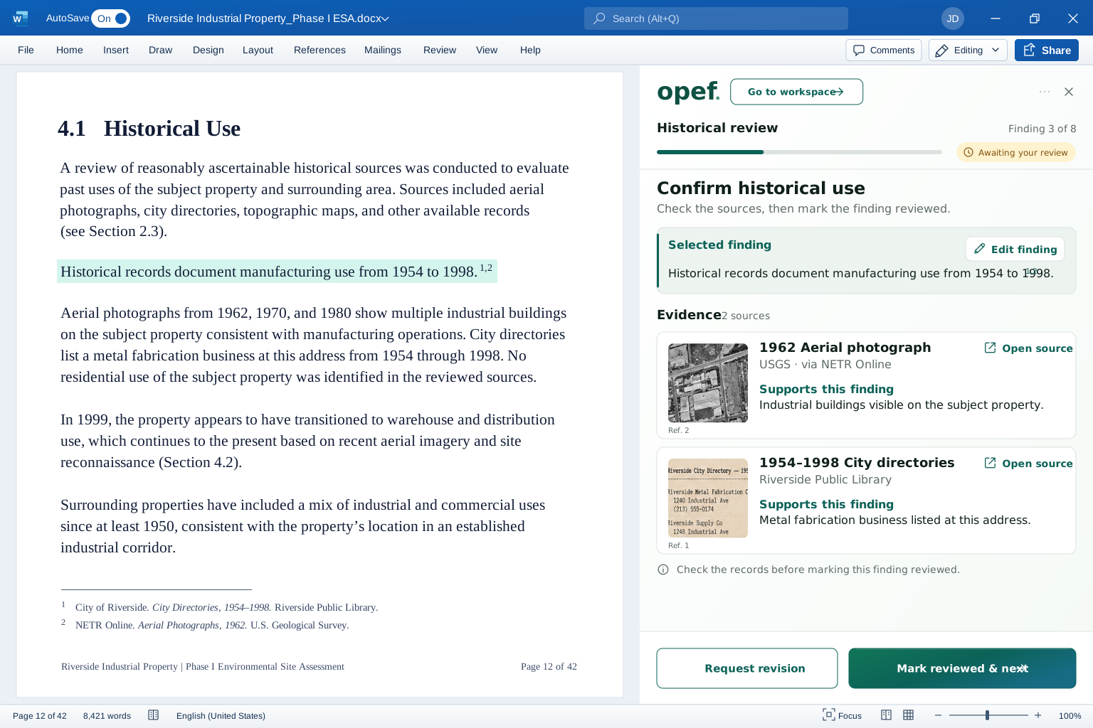
Available historical records indicate the subject property was developed with manufacturing use in 1954 and operated as a metal fabrication facility until 1998.1 Aerial photographs and city directory listings corroborate industrial use during this period.2,3

No evidence of underground storage tanks (USTs) was identified in historical records, aerial imagery, or regulatory databases reviewed for the subject property.4,5✓   Inserted by OPEF

4.2    Regulatory Records

A search of federal and state regulatory databases identified one off-site RCRA Small Quantity Generator (SQG) site located approximately 0.25 miles downgradient from the subject property.6 No additional significant regulatory listings were identified for the subject property.

Page 12 of 328,421 wordsEnglish (United States)▣ Display Settings━●━   100%

You make the call.
OPEF shows the work.

Review the sources behind each finding, check what’s missing, and make the final decision.

OPEF determination review — transparent foreground opef. Determination review Finding 3 of 8 ● Awaiting your decision The evidence Original sources. Direct from the record. What the records support Cited findings from reviewed sources. Your determination Environmental Professional review. 1956 Sanborn map Two tanks marked on the western parcel. Sheet 12 Open source ↗ 1 1960 City directory Automotive service listed at this address. Polk’s City Directory Open source ↗ 2 Historical automotive use and two underground storage tanks were identified.¹ ² 1 1956 Sanborn map 2 1960 City directory ! What remains unresolved Removal records were not found in the reviewed sources. Professional note Review tank closure documentation before finalizing the determination. Request more evidence Record my review Your review, note, and decision are saved to the audit trail. Audit trail A transparent record from draft to determination. OPEF drafted Draft created Sources linked 2 records attached Your review pending Awaiting your input

All-in-one workspace.
Your work, connected from start to finish.

Research, draft, review, and send without losing track of anything.

01   Gather records02   Draft in Word03   Review with confidence
OPEF — from records to review-ready findingsHistorical aerials and city directories each connect to the cited draft finding. Two continuous threads connect that finding to its two supporting evidence cards. Regulatory records are connected to the project, but are not cited for this finding. Source library + Add source Connected sources for this project Historical aerials USGS, local, and commercial imagery Connected City directories Sanborn, Polk, and local directories Connected FEDERAL REGISTER Regulatory records USEPA, state, and local records Connected 3 source groups connected W Phase I ESA.docx AutoSave On ··· File Home Insert Draw Design Layout References Mailings Review View Calibri (Body)⌄ 11⌄ B I U 1 2 3 4 5 6 4.1 Historical Use Historical research, including aerial photographs, city directories, and regulatory records, indicates the subject property was used for manufacturing purposes from at least 1954 to 1998.¹,² Historical records document manufacturing use from 1954 to 1998.¹,² Aerial imagery from 1962 shows industrial buildings on the property, and city directories consistently list a manufacturing tenant at the site through 1998.¹,² Review the finding Awaiting your review Historical records document manufacturing use from 1954 to 1998.¹,² Supporting evidence (2) 1962 Aerial photograph USGS historical imagery Reference 1 1954–1998 City directories Historical city directories Reference 2 Request revision Mark reviewed & next →

Every record, together.

Access historical records, regulatory databases, aerial imagery, and more—all in one project.

Your template. Cited drafts.

Insert well-cited findings directly into the Word format your firm already uses.

Your judgment, supported.

See the supporting record beside each finding, request changes, and approve with confidence.

Works wherever your reports
and data live.

OPEF works inside Word, connects to your project systems, and
researches across environmental data sources.

Your reports

Microsoft WordPhase I ESA.docx

4.1 Historical Use

Historical records indicate the subject property was used for automotive repair from 1968 to 1994.

A 1987 Sanborn map shows the presence of underground storage tanks (USTs) on the western portion of the property.

No additional environmental concerns were identified in available historical sources.

Page 12 of 28  4,326 words

Draft in your existing templates.

Intelligence in
your workflow.

Your project systems

SharePointComing soon
OneDriveComing soon
ArcGISComing soon

Your research sources

ERIS / LightBox EDR
EPA ECHO
State UST & LUST
USGS
County parcel GIS
184 research sources
Same tools. Deeper insights.OPEF

BUILT AROUND YOUR PRACTICE

See OPEF work inside your Phase I report.

Bring one of your templates. We’ll walk through the research, evidence, drafting, and review flow together.

Book a workflow review